
Walk an Addison Street by Address
An Addison address search becomes reliable when each record supplies the key for the next one. The assessor identifies a parcel and its current billing name. GIS shows where that parcel sits among adjoining lots. The Recorder links the parcel or legal description to recorded parties. Village permits date work at the site. Voter records add limited election geography, while older reverse directories can associate a name with an address at a past date. None is a complete household roll.
- Enter the house number and street in the DuPage Property Lookup address search. Open the result and save its PIN, situs address, billing name, and legal description.
- Find that PIN in the DuPage GIS Parcel Viewer. Pan along the road or select nearby shapes to understand the parcel pattern.
- Use the PIN, street, city, or a named party in the DuPage Recorder search. Match documents by legal description and date.
- Check the Addison CityView permit locator for work tied to the address. A permit dates activity, but does not prove who occupied the site.
- Use the DuPage voter address form only for the limited match and district facts it lawfully returns. For an older resident clue, consult local criss-cross and telephone directories.
The flow is address → PIN → mapped parcel → recorded document → dated local evidence. It keeps an Addison street directory grounded in records that can be checked again.
Addison Street Directory Parcel Keys
The DuPage assessor portal has separate modes for an address, PIN, billing name, map, and Board of Review hearings. An address result is a starting point. Clicking the PIN opens a card with current tax context, owner or billing name, situs and mailing addresses, legal description, class, exemptions, district stack, and links toward the property tax bill. A mailing address may be elsewhere, so it must not be treated as proof that the named owner lives on the parcel.
| Search choice | Input | Best street use | Important limit |
|---|---|---|---|
| Address | House number and street | Turn a known place into a PIN | Current spelling must match |
| PIN | Four-part parcel number | Reopen the exact land unit | It identifies land, not a household |
| Billing Name | Owner or billing surname | Find other matching tax cards | Billing name is not occupancy proof |
| Map | Mapped area | Browse parcels in place | Use GIS for fuller spatial tools |
The official address-search screen shows the protected portal route used for this first step.
Its separate address mode helps prevent a name search from being mistaken for a street-wide list.
The portal also has a dedicated PIN search for returning to the same parcel.
Saving the PIN creates a stable join between assessor, GIS, deed, and permit research even when an address label varies.
Four Addison Address Identities
Addison records can carry four different address keys. The situs address is the physical location. The mailing address is where tax mail goes. The legal description names the land through a subdivision, lot, block, township and range, or another recorded form. The USPS ZIP describes mail delivery. Keeping all four prevents a common street-directory error: assuming every text address refers to the same person or boundary.
- Parcel or PIN
- The county's unique number for a land unit. It is often more stable than a street label.
- Situs address
- The location assigned to the parcel or building, distinct from the owner's mailing contact.
- Plat
- A recorded map of lots, blocks, subdivisions, easements, or dedications.
- Criss-cross directory
- A volume arranged by address or phone number so a place can lead to a listed name.
The Village assigns building numbers and maintains its street and highway plat. The Addison address-number authority explains that municipal role.
That local authority supplies the current number, while county and postal systems keep their own linked forms of the address.
Address Records Across Addison Streets
Each keeper answers a narrow question. The strongest street directory uses the source that matches the claim, then follows its documented offline route when the browser cannot finish the work.
| Address record | Official keeper | Street evidence | Access route |
|---|---|---|---|
| Parcel card | DuPage County Assessor | PIN, billing name, situs, mailing and legal fields | Free portal; office at County Farm Road |
| Parcel geography | DuPage County GIS | Boundaries, nearby parcels, districts and selectable layers | Free viewer and official PDF guide |
| Deeds and plats | DuPage Recorder | Recorded parties, transfers, liens and land descriptions | Online index; terminals, research line and manual books |
| Permit history | Village of Addison | Application, PIN, status and activity dates | CityView; Village FOIA for non-indexed files |
| Voter geography | DuPage Election Division | Allowed match, precinct and district facts | Official exact-address form with redactions |
| Reverse volumes | Wheaton Library and Addison Museum | Names listed at addresses in selected years | Library or museum research contact |
Current ownership belongs to the assessor and Recorder. Historical occupancy is a softer conclusion that needs a dated directory, census, newspaper, or other source. The dedicated Addison city directory page covers the historical collections themselves.
Map Addison Streets in GIS
GIS gives the street-by-street view that a parcel card lacks. The official guide documents Basic, PIN, Advanced, Shapes, Buffer, report, map, and download controls. A user can select parcels on the map, create a buffer that defaults to 250 feet, or export selected PINs in TXT, CSV, PDF, XLS, or XLSX format. The light-blue selection shows land units, not people.
Use the map to see which parcels touch a road, then open each PIN separately in Property Lookup. Compare situs, mailing, and legal fields. District layers may also show why two Addison addresses carry different township or road-district labels. The official Parcel Viewer guide remains useful when a live control changes position.
GIS tip. A 250-foot buffer can frame nearby parcels, but the exported PINs still require individual record checks.
Recorded Names Along Addison Streets
The Recorder search accepts last and first name, bank or trust name, subdivision or business name, street number, direction, street, city, PIN, document number, document type, and date range. Address searches begin in 1995, PIN searches in 1985, and name searches in 1961. Images and indexed documents begin March 16, 1961. Plats reach back into the 1800s, while in-office property research extends to DuPage County's start in 1839.
Select a document number and inspect the deed or plat. A grantor transfers an interest; a grantee receives it. Match the legal description and PIN before linking the named party to the Addison site. If the new search is down, call Recorder Research at 630-407-5401 or use public terminals at 421 N County Farm Road in Wheaton. Certified copies also route through the office.
Note: An assessor sales row can point to a deed, but only the Recorder supplies the recorded instrument and its complete indexed context.
Date Addison Address Activity
CityView adds municipal dates to the parcel chain. Its permit locator searches an address or application number. A Property Review result can show the address, PIN, address history, a privacy-limited historic owner display, and linked permit records. Permit details can include application number, status, description, issue, expiration, and final dates. These facts show work at a site, not everyone who lived there.
The official CityView property review demonstrates the address-keyed municipal record.
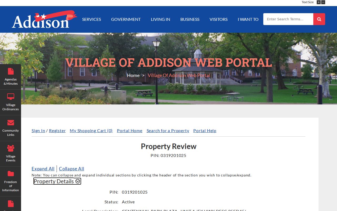
The linked permit rows can date public work after the parcel has been confirmed through its PIN.
For a public permit or code record that CityView does not expose, use the Addison JustFOIA portal. The May 2026 Village guide permits inspection, electronic delivery, or paper copies and gives a general five-business-day response framework.
Lake Street in Addison Records
Addison maintains about 80 miles of Village roadway, excluding state and county routes. The main road list includes Lake Street, Rohlwing Road, North Avenue, Villa/Wood Dale Road, and parts of Army Trail, Addison Road, and Swift Road. The Village roads and streets page helps identify which public body may hold a road record.
Jurisdiction matters when a request concerns a roadway rather than the private parcel beside it.
Lake Street is also US Route 20. The Addison Historical Museum traces it from an Indigenous trail to an 1830s stage route, paving in 1922, and the federal highway system in 1926. Search both labels in old records. If neither works, carry the legal description and plat into the Recorder index.
Addison Deeds Before Online Search
DuPage's old record arrangement explains why a name can vanish from a street trail. The archival inventory describes entry books from 1839, missing volume periods in 1860-1865 and 1874-1878, and town-and-range arrangement for 1866-1873. Five books stolen during the 1871 courthouse fire remain part of the Recorder's preservation story. A failed name result is not proof that no instrument existed.
Try the legal description, subdivision, lot, plat, seller, grantee, town and range, and date window. Then ask Recorder Research whether a manual series or missing book affects the trail. This historical fallback is one reason an Addison street directory cannot be web-only.
Limits of an Addison Street Directory
Parcel and deed records identify owners and recorded parties. They do not list every person at an address. A residential class, exemption, or matching mailing address still does not prove physical residence. CityView dates municipal activity. The voter lookup is restricted, redacts sensitive information, and is not a block-wide household display. Driver records and private utility customer data are not open street-directory sources.
Historical criss-cross entries are dated snapshots and may omit unlisted residents. Postal geography also differs from Village limits. Addison ZIP 60101 does not create a guaranteed municipal boundary or a ZIP-wide directory. Confirm the exact parcel, date, and custodian before drawing a conclusion.
Lawful use. Use Addison address records for family research, property history, civic inquiry, or scam checks. Never stalk, harass, intimidate, or harm anyone.